The EU LIFE Environment and Resource Efficiency project „Healthy Forest” aims to design and apply advanced methodologies to achieve a more sustainable forest management in the field of control and prevention of forest decline caused by invasive and pathogenic agents. An important step toward this objective is the development of an early detection system and monitoring of forest health in the field, in the laboratory and by remote sensing. The sub-project conducted by the Geographic Information Science (GIScience) group at the Department of Geography of the University of Jena focuses on spatial modeling of forest disease potential at the regional scale, and on the application of computational and statistical techniques to identify significant predictors of forest decline in high-dimensional hyperspectral remote-sensing data.
Objectives and approach
The specific objectives of this project on “Early detection and advanced management systems to reduce forest decline caused by invasive and pathogenic agents” are to:
- Develop an innovative and unique integrated system for the early detection and evaluation of the impact of forest decline by combining techniques that range from the molecular to the remote-sensing scale;
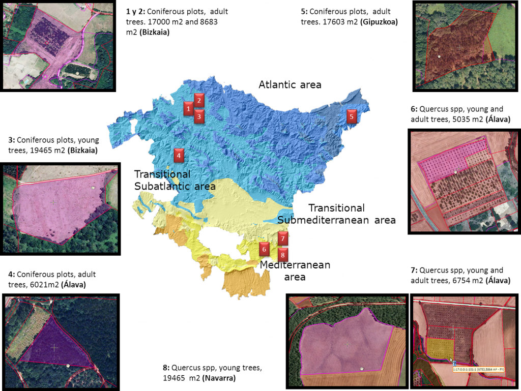
- Implement an early detection system in large-scale demonstration plots in northern Spain, giving a comprehensive vision of the status of forest health as knowledge base for EU policy;
- Implement accurate and cost-effective forest management techniques based on the results of the innovative system and analyze traditional management strategies;
- Develop and implement a geographical information system (GIS) infrastructure for the estimation of economic and environmental impact of forest decline;
- Provide baseline data and information on the status of forest decline at different scales of analysis with main invasive and pathogenic agents in the European Union;
- Involve public and private stakeholders to achieve replicability and transferability at the EU level;
- Contribute to the objectives of the New EU Strategy and the EU Biodiversity Strategy to 2020.
Data-driven techniques for geospatial “Big Data” play an important role in the contribution of the GIScience group of Prof. Brenning to this project. This research involves, in particular,
- the development of knowledge discovery methods to identify relevant subsets of predictive features in hyperspectral remote sensing,
- the use of machine-learning techniques for predictive modeling in a high-dimensional setting, and
- the application of nonlinear spatial statistical models for geospatial modeling of forest disease potential at the regional scale in response to environmental conditions.
Among the expected outcomes of this project are an improved early detection capacity for forest decline, a GIS infrastructure available to a variety of stakeholders, and ultimately improved forest health and wood quality as well as associated environmental, economic and social benefits.
Project partners
NEIKER – Instituto Vasco de Investigación y Desarrollo Agrario (coordinator)
Desarrollo de Estrategias Exteriores S.A.
Friedrich Schiller University, Chair of Geographic Information Science
Fundación Hazi